Parambikulam, day 2
18/01/2014
Over a week back stateside and between jet lag and the start of a new semester I’m still not even halfway through this chronicle. It’s getting a bit harder to sort out the details, but I’ll do my best.

Kannimara. Possibly the oldest and largest teak tree in the world, spared from felling by allegedly spurting blood.
The second day of sampling at Parambikulam is practically stress-free. We get a decently early start on the morning’s collection but squeeze in a visit to the Kannimara, one of the largest teak trees in Asia and recognized with the Mahavriksha Puraskar (Giant Tree Award). This aboriginal tree is said to have escaped felling because it spurted blood when initially struck by the axe (or whatever tool was used), and it has since been worshipped as the “virgin tree” (roughly the translation of “Kannimara”). I’m left to presume that all of the other teak trees from Kannimara’s vintage were taken down for being less sanguine in xylem, and therefore all of the standing teaks we see today (all much smaller) are secondary growths from replantings and natural propagation from the replanted stock.

Etroplus. The presence of native cichlids on the Indian subcontinent reminds us that this land mass broke off from the southeast coast of Africa–where these fishes’ closest relatives are centered–less than 100 million years ago.
Our first sampling of the day takes us out onto a stream in a different part of the reserve as yesterday, though the fish we sample are quite the same as what we have been collecting. Then we make two short stops before making our way to a sampling site that would turn out to be the most perfect of the places I visited on this trip.
One of the spots was on Turnakadavar Lake near the inflow from a water tunnel coming from another reservoir over 2.6 km distant. In the development of a reservoir project, it’s a common practice here to connect different watersheds with tunnels. Within the boundaries of Parambikulam Tiger Reserve there are two reservoirs, Turnakadavar and Parambikulam, that are linked by this tunnel. I’m not entirely sure about the rationale for connecting these two watersheds, but I suspect that Turnakadavar is closer to the Palakkad Gap and is just a stop on the route connecting the larger water source of Parambikulam Lake to population centers like the city of Pollachi.

Two species of mahseer. The one on the bottom has a more protruding mouth as well as a long barbel under its chin. These two are small, but mahseer grow large (some species to 20 kg) and were targeted by sport anglers during the period of British rule.
At Siruvani Lake—on the shores of which we stayed at Patiyar—there is a tunnel that carries reservoir water under Siruvani Mountain to the Tamil Nadu side where it serves as one of the important sources of domestic water for Coimbatore city. Water that would normally drain to the Arabian Sea on the Kerala side of the Ghats is being sent under the divide and into a watershed that normally drains into the Bay of Bengal. From the standpoint of supporting the needs of humanity, this type of alteration to the hydrology is perfectly sensible. The Tamil Nadu side is more arid being in the rain shadow of the Western Ghats, and so if you can send water from the Kerala side where it is more abundant under the mountains to Tamil Nadu, well that just seems like a great idea.

The “middle stretch” of the Western Ghats. The part I visited extended from Periyar (just out of view to the south) to Wayanad (just out of view to the north). The Western Ghats ecosystem actually extends across the strait and onto Sri Lanka in the south and northwards through the state of Karnataka and into Maharashtra.
From the standpoint of conservation, this is a disaster. On paper, the topography of the Western Ghats seems ideal for the study of species originations, particularly for the small hillstream fishes that we are sampling. On the Kerala side, there are a handful of distinct, major watersheds that drain directly into the Arabian Sea. On the Tamil Nadu side, almost all of the water flows into the Bhavani River, which joins the Cauvery River that empties into the Bay of Bengal to the east. Each watershed has dozens to hundreds of tributaries, many of which have perennial flow, thanks to the area’s climate and geology: two seasons of monsoon (and therefore no dry period of extreme duration) and impermeable bedrock underlying the red clay soils—i.e., plenty of water percolating through the soil and re-emerging when it hits the bedrock.

As we were preparing lunch, someone noticed a large snake crossing the river and heading directly toward our site–either a king cobra or a sarapan (black rat snake). It ducked into a crevice in the bedrock, but nobody wanted to get too close to make the definitive ID.
Many of the hillstream fishes are adapted to small flows near the headwaters, and thus it may be unlikely if not impossible for them to migrate down to confluences with other drainages and then back up to the headwater habitats that they prefer. It’s reasonable enough to predict that these hillstream fish populations are genetically isolated from other similar fish populations, and this is precisely the condition of allopatry that leads to the eventual evolution of species differences between what are initially different populations of the same species. This type of geography strongly favors new species originations in a way that doesn’t happen in oceanic fishes, and it is for this reason that the majority of fish species in the world live in fresh water, despite the fact that their available habitat is not even a thousandth of what is available to saltwater fishes. The Western Ghats should be an ideal place to study the process of the origin of new species through allopatric speciation… if it were not for its long history of human disturbance.

This is as close as I wanted to get. It turned out to be just the harmless colubrid. Darn.
But “absence of human disturbance” does not really exist in the Western Ghats. Even the deepest and most remote spots have all been touched by more human feet than tiger paws—this much is certain, but what is more difficult to estimate is how profound a mark has been left behind by the human traffic. For the hillstream fishes, the alteration of the hydrology have likely resulted in some gene flow between watersheds that would otherwise not be possible—migrations through tunnels or reservoirs are likely to have disrupted the process of speciation. To make matters worse, many of these fishes native to Indian hill streams are popular among aquarium hobbyists worldwide, and the value of rare and novelty species has generated a sizable commerce of fishes caught from the wild. This will have impacted the genetic structure of hillstream fish populations as collectors will have attempted to establish breeding populations of more valuable species in areas where they are not native.

Sampling site on the Chalakudy River (or a tributary) downstream of the Turnakadavar Dam and upstream of the proposed Anakayam Hydroelectric Project
It is also entirely true that the vast majority of fish habitat in the hills of southern India has been lost to development for human use, and its water has been diverted into irrigation systems to serve tea plantations, rice paddies, and other croplands—resulting in unknowable extinctions of native and endemic species of fishes as well as other stream-dependent invertebrates and plants.

All of this has been (an overly long) preamble or sidebar to a story emerging from one of the documents that we picked up from our chats with officials the previous morning. A new hydroelectric project is being planned for the Chalakudy River downstream from where we sampled in Parambikulam, and if the project goes through, an extensive area in the buffer zone southwest of the reserve would be flooded. The reservoir would not extend into the core area of the Parambikulam reserve, as that would break the rules prohibiting human exploitation within designated areas of critical tiger habitat… but it would come very close.

Make-shift wood stove using the natural crevices of the local geology (basaltic bedrock, I think). Dr. Mani starts the preparation of a fresh sambar with the boiling of toori dal (medium-size yellow lentils).
As I mentioned before, our third collection site of the day is remarkable for its beauty. Our river—which is either the Chalakudy or a major tributary—weaves its way over a stream bed of rippled and contorted basalt and forming a vast spread of pools and mini cascades. This habitat supports big fish and little fish, frogs and snakes, birds and all of the mammal species that can be found in southern India. It’s highly protected but still subject to fish harvesting by tribals (as well as researchers). But sitting on a boulder in the middle of this stream bed, which is in the middle of the largest tract of protected forest that we have seen, I am about as distant as anyone can be from humanity—at least in the southern stretches of this very populous country.
Dr. Mani set up a make-shift wood-fire stove on the bank under the streamside trees, and we cooked sambar and fish (a Puntius carnaticus and several larger Garra)—rice, too, but we used the gas burner for that. There was a period of tenuous curiosity when a large snake—either a king cobra or a black rat snake (Pytius mycosa)—holed up in a crevice near our lunching site—it turned out to be a rat snake. We caught our first native cichlid (genus Etroplus), as well as two species of mahseer. It was a great afternoon at a great site and is the spot I hold in memory as my locus amoenus in India. I will be saddened when the rare remoteness of this location is sacrificed with the impoundment of the Chalakudy and creation of a reservoir just a mile downstream from here.


Topslip is the part of Anamalai that is adjacent to the Parambikulam Tiger Reserve.
26 December 2013. Summary: Spent morning negotiating the accommodations with officers at both Topslip and Parambikulam. Collected at two sites deep within the core area of Perambikulam in an area of no public access, with Selvan our accompanying forest official for the day. Today’s sites would be 1) a tributary of the Kuriarkurthi River way below the dam at Turnakadavar Reservoir, and 2) a slow stretch of the Kuriarkurthi itself in the same general area.
The Anamalai Tiger Reserve and Parambikulam Tiger Reserve together comprise a fairly large tract of protected area south of Coimbatore and detached from the Nilgiri Biosphere Reserve, which includes the forests of Siruvani and Silent Valley. Anamalai is the part occurring within the south Indian state of Tamil Nadu and it includes the Topslip Forest, which is where we stayed at the guest house. Parambikulam is the part within the state of Kerala. Each reserve has its own administration, paid for by the state in which it occurs. Research and collecting permits are issued by the state government, and while Dr. Mani has permission to collect in Kerala, his permit is not valid in Tamil Nadu. However, Dr. Mani is a big fish to the Topslip management because of his history there. He has spent a lot of time collecting at Topslip in the past, and he provided all of the fish specimens at the little natural history museum they keep at the visitor’s center.

Preserved specimens of fishes collected by Dr. Mani and on display at the visitor’s center in the administration area of Topslip.
The gap between Anamalai/Parambikulam and the Siruvani/Nilgiri Hills to the north is a break in the Western Ghats called the Palakkad Gap, and this is a corridor for westerly air movement from the onshore flow coming off the Arabian Sea. Lower in elevation, it is also entirely under intensive use by human activity, including major routes of travel between the two states. Neither Anamalai nor Parambikulam can claim a large percent of cover by primary vegetation—being so close to the transportation corridor, this area has a long history of exploitation. During the period of British rule it was found to be ideally suited for the cultivation of teak, whose wood is highly valued for ship building. Native forest was cleared and replanted with teak, and even though timber harvest is no longer permitted, much of the landscape is teak monoculture with patches of bamboo. In time (it is hoped), native vegetation will slowly work its way back through competition and succession. Topslip was so named by the British because of its topography. Teak logs could be hauled up he hill and allowed to slide down into the Palakkad Gap—hence the name “top-slip.”

I noticed a sign saying “Bridge out. Do not pass” and there were several broken planks.
Dr. Mani spent much of the morning putting out metaphorical fires: phone calls to the high official who reluctantly bent the rules in allowing us to enter after hours, placating the on-site rangers whose bosses were called to make the exception to what is otherwise a strictly enforced policy. We also didn’t have a place to stay for the next night—the guest house at Topslip was going to be occupied by a different group. We went to meet with the Topslip Ranger in his office–I sat in that meeting, presumably as a bit of leverage, as in, “We must provide some nice accommodations for our international guest.” That meeting transpired entirely in Tamil. On our way in to Parambikulam we made a stop to visit the District Forest Officer (DFO—a higher rank than Ranger) to see if there were strings that could be pulled to get us some lodging there. Again I was brought in—only this time the meeting was conducted in English.

Dr. Mani tests his camera case for underwater photography after recording some observations made with snorkel/mask.
At this point I’m beginning to notice an intriguing pattern. Both of these officials were native speakers of Tamil with passable English skills. Somewhere in between the levels of Ranger and DFO was a switching point. English use is a demonstration of education and worldliness. Sometimes English is necessary, as when one of the players is not a Tamil speaker. But an Anglophonic conversation between two Tamil Nadu natives of status is like a staring contest, and having to switch over to Tamil language is like blinking. I wonder about the efficacy of this social code. Although I do not understand Tamil at all, it was evident that the conversation between Dr. Mani and the Ranger in Topslip was fluid and comfortable while the other seemed stilted by the socially imposed formality of using what is a second language for both parties. We had the same objective for both meetings—we needed to secure lodging for that evening and no quarters were available (officially) in either place. Both had the same outcome: nothing promised, but if a cancellation were to occur then we would get that space.

A substantially sized turd with berries? It can only be bear shit, a.k.a. “nature’s fruitcake.”
It’s possible that my presence may have added to the impetus for speaking in English, but I do not believe that it was a major factor. In Dr. Mani’s many phone conversations he spoke either Tamil or English, and I was not party to those exchanges. When I asked him how he decided which language to use, his answer basically confirmed the model that I had been formulating, described above. What is the overall cost of this practice, in terms of effective communication? I suspect that communication is fine at the two ends of the hierarchy: the highest-ranking officials are likely to be very fluent in English, while workers in the lowest levels don’t even bother and just go about their business using their mother tongue. But in the many tiers of middle management where the English of one or both parties is imperfect, there is going to be some breakdown in communication resulting only from the conversants’ pride and unwillingness to switch over to a more comfortable language.

Travancoria sp. This flat-bottomed, sucker-mouthed cyprinid holds tight to rocky bottoms in fast-flowing parts of the stream.
Corporations in India tend to organize personnel into many-tiered hierarchies, and position within a hierarchy is what defines status. An employee interacts with others as equals, subordinates, or superiors, and the authority of one’s superiors is accepted without question. As an academic Dr. Mani is outside of the forestry hierarchies, and over the course of 25 years of fieldwork he has established connections with high officials in forestry and wildlife as well as many long-tenured employees in the lower ranks—we spend a lot of time meeting and catching up with Dr. Mani’s old acquaintances at all levels. But it is having the friends in high places that has gotten us the favorable results of entry into Patiyar and Topslip after hours. Dr. Mani has played this angle twice already—with some implicit detriment to his credibility. Both delays were unforeseen and unavoidable (vehicle issues), but he tells me that from this point forward we will have no further trump cards to play.

The second site along the Khuriarkurthi River, where I ate my first Puntius carnaticus and saw my first Great Indian Pied Hornbill.
It was getting close to noon that we picked up Selevan, a forest guard from the tribal community, to accompany us for the afternoon’s collection. Our route took us deep into the core area of Parambikulam well beyond the parts of the reserve that are available to tourists. Over a wooden bridge that was signed “unsafe bridge—do not cross” and alongside a stretch of river flowing over a chiseled bedrock of basalt, and further down we pulled up to a tiny tributary for the first of the afternoon’s collections. The spot had many of the same general fish forms as before—Garra, Rasbora, Puntius, Barilius, and loaches—but there were a couple of genera that we had not gotten at Siruvani. Danio is the same genus as zebrafish, which is one of the most important model organisms for developmental studies. Travancoria is a fast-water algae eater with a streamlined body and a strong sucker-mouth allowing it to hold tight to boulders in the fast-flowing runs that it prefers. And Tor, which is the fabled mahseer of sport-fishing fame. We only caught a couple of very small mahseer, but their presence indicates that this stream has perennial flow. We collected fish, recorded stream data, and Dr. Mani put on his snorkel and mask to conduct some observations and to test out the waterproof case that I brought him for his very expensive Canon DSLR. The case held its water-tight seal, but some moisture had been introduced inside the case by wet hands resulting in glass fogging and poor photo quality. No photo shoot of collected fishes today though as we were time-constrained.

Puntius carnaticus sautéed in coconut oil and coated with fish-fry masala, salt, and wheat flour.
The second site was a wide, slow stretch of river and the team deployed a gill net while I tried to “sample” with a telescoping rod and reel that Dr. Mani kept in one of the many bags we hauled around. I didn’t have any luck, but the gill net yielded one fat Puntius carnaticus, which was dispatched, clipped for DNA, and then prepared for my special lunch.
Today’s lunch was prepared entirely in the field. Magesh cooked rice in a pressure pot over a gas flame, and he also prepared chicken curry from scratch. Well, almost from scratch. Chicken, vegetables (onions, green beans, carrots, potatoes), and masala. The Puntius was scaled, eviscerated, split, and the skin was scored. A “fish-fry masala” was mixed with salt and rubbed into the flesh, some flour was added, and this was fried in a dosa pan (basically a slightly concave crepe pan). Cyprinids (minnow family fish) aren’t considered food fish in the U.S., but this was really good.

Great Indian Pied Hornbill. Photo by Manimekalan. Parambikulam Tiger Reserve.
As afternoon stretched into evening, Arun and Magesh processed the fish we collected from the earlier site. A Great Indian Pied Hornbill alit on a tree across the river from us. Without binoculars, the bird was clearly visible but distant. With the super lenses on the cameras that Dr. Mani and Arun were carrying, however, it was possible to capture some nice detail, even without a tripod for adding stability on the long-distance shot. On the road back to camp, we got views of Spotted Deer, Gaur, Sambar Deer, mongoose, and civet cat.

Spotted Deer. Photo by Manimekalan. Parambikulam Tiger Reserve.
That evening Dr. Mani pulled out a couple of almost-cold beers from his backpack, and this was better than what we had taken to Siruvani. I ask Arun if I was meeting his expectations, and he confided that he had hoped to be learning from me. Maybe it’s a hierarchy thing—I was a professor, he was a student, so I supposed to profess while he absorbed the pearls of scientific knowledge spilling forth from my parotta-hole. To this point I had been on the receiving end of the learning, although this was mostly because I was reticent to take a lead role in teaching the Indian scholars about Indian natural history. But it was also becoming increasingly evident that both Arun and Magesh were a bit behind the curve in some foundational areas of ecology and evolutionary biology. I could contribute by helping to fill some of those gaps with lessons along the way. The problem with this idea was we were continually traveling under cramped conditions or working on the fish collections, and Dr. Mani kept the scholars busy at other times with cooking, equipment maintenance, loading/unloading of the vehicles. There was no opportunity for me to offer any substantive lessons to the scholars, though I did have abundant time in discussions with Dr. Mani.

Indian Gaur. Photo by Manimekalan. Parambikulam Tiger Reserve.
My proposed solution: after Parambikulam I was planning to take a couple of days to travel to Cochin by myself—to see and soak my toes in the Indian Ocean, eat some seafood, and take a backwaters tour. Why not invite the scholars along? They could enjoy a couple of days reprieve from heavy lifting, stay in a nice hotel, and take an opportunity for some more substantial biology lessons along the way.
Silent Valley and onwards to Anamalai
10/01/2014

Camel procession on Xmas morning 2013 in Mukkali, portal to Silent Valley, Kerala.
December 25. We found an electronics shop not far from the guest house and bought a phone charger and put in enough juice so that Dr. Mani could advise Arun of situation. Jesus has a pretty large presence here, but not enough to shut things down today. There was a procession with three camels that came through town that was probably some kind of nativity reenactment.

Jackfruit, Artocarpus heterophyllus. Native to Kerala but now found across the world’s tropics.
Feeling relieved at being back in contact with the world, Mani and I took a Jeep tour of Silent Valley with driver Mustafa. Just inside the buffer zone there is a sizeable village of tribal people, who are the buffer zone’s primary users. As a national park, the protection of Silent Valley’s core area extends to prohibition of use by tribals, unlike the state-managed tiger reserves and wildlife sanctuaries. We drove through stretches of forest with black pepper vines ensheathing the trees and coffee growing in place of the understory. One of the restrictions of buffer zone use is a ban on the felling of trees, so the shade for the coffee and the support for the black pepper is provided by mostly native species of tree. Cultivation of plants like coffee and pepper is also not allowed, but these particular plantings pre-date establishment of the restrictions, so the tribals are allowed to continue to harvest this coffee and pepper as “forest products.” Also the use of pesticides is also prohibited in the buffer zone, so the products grown in reserve buffer zones are all certifiably “organic.” Not all of the trees were native. There were a few recently planted coconut palms in the outermost layer of the buffer zone. There were teak trees, which though a native species has had its range extended by active planting both during and after the period of British rule. There was a large jackfruit tree, which can be found as a “welcomed and permanent guest” across the world’s tropics but is native to the forests of southwestern India, i.e., exactly where we are.

30 m watchtower at the end of the road into Silent Valley. This and the trail down to the Kundhi River bridge are the only places in the core area where foot traffic is permitted.
At the end of the road there is a 30 meter watch tower that evidently not too many people are willing to climb—we had the top platform to ourselves until we had our fill of the incredible view—360° of nothing but wild primary tropical evergreen forest, and this is not more than 30 km from the very dense human population that covers most of India’s surface. [but see epilogue below]
There’s no way to describe the insane majesty of this place. The video I took can’t capture how special of a place this is. But there’s a subtext to Silent Valley, and it is a very encouraging story on how the role of humans in conservation activism can make a huge difference.
Providing energy for India’s already huge and growing population and growing economy is obviously a huge challenge. Thermic energy from the combustion of coal is one of the two principal sources. Many newer plants are using cutting-edge methods to maximize the efficiency and minimize the pollution from coal combustion. With a large stock of coal, India will be powering its future growth for some years to come. But even with the imported German technology, coal still emits more carbon per kilojoule than other forms of fossil fuels. In recent years much of the “fully developed west” including the U.S. has managed to reduce its carbon emissions, largely by transitioning from primarily coal to primarily natural gas or (better) to carbon-neutral sources. Coal-dependent India and China are projected to be the major contributors to increases in atmospheric carbon for years to come as their economies continue to rise. Let’s hope that they are able to move rapidly over to cleaner and more sustainable sources.
The other major energy source is hydroelectric, and really—why not? This subcontinent is blessed with monsoonal precipitation that is mostly quite reliable, and the topography of much of the country contains large, narrow canyons carved by rivers out of the elevated highlands—perfect for the construction of dams that use of gravity to make electrical energy with no carbon emissions at all. It’s basically another natural resource available to the Indian population. The Western Ghats contain many reservoirs. Most—like Siruvani Dam—are used only for storing water for steady domestic water and irrigation, but larger projects are built for both storage and hydro-power.

Kundhi (Kunthipuzha) River from the bridge at the end of the foot trail at Silent Valley National Park, Kerala.
The unfortunate consequence of damming rivers in this way is the disruption of natural riverine habitat. The stream bed and terrestrial systems on both faces of the canyon being flooded are lost. The flow pattern changes downstream of the impoundment—instead of fluctuating between running high and low, there is a steady flow through the canyon. I’m reminded here of our very own Grand Canyon, where ever since the construction of the Lake Powell dam upstream there has been an accumulation of bigger rocks and boulders that historically would get cleared downstream by flood periods.
It also cuts off any migration between upstream and downstream parts of the river. Maybe some downstream migration is possible if an upstream river fish were to swim through the lake and over the spillway (better that than through the turbines), but the reverse route would be impossible. This is a potential area for studies in population structure by scientists like Dr. Mani and Arun.
There are other losses as well. The one coming to mind and causing the greatest outcry from people is when waterfalls are lost. I can’t help but mention here the “Sete Quedas” (7 Falls) that were destroyed to make the enormous impoundment on the Rio Paraná in Brazil. I say “destroyed” and not just “flooded” because the rock masses creating these spectacular falls (bigger than Niagara and close to Iguaçú in awesomeness) were dynamited and reduced to underwater rubble in order to make the lake more easily navigable by large cargo ships. The sete quedas project obviously went through in spite of the protests. There’s a very sad note in this Brazilian story, in which a suspension bridge collapsed under the weight of dozens of people during a protest and resulted in loss of human life.

Silent Valley is moist evergreen forest. Its core area is perhaps the best example of primary rain forest vegetation in the country.
If you google “Silent Valley” you’ll probably come up with older links to the news items arising from protests in the late 1970s and early 1980s by local environmentalists when the Kerala government wanted to impound the Kundhi River to create a source of hydroelectric power in Silent Valley. Only in this case the national government actually listened to the protesters and intervened. The project was axed when Delhi stepped in (Indira Gandhi herself, actually) to create the national park at Silent Valley with the stipulation of absolutely no development or exploitation within the park’s core area—except for the Jeep tours to the watchtower, and this is only allowed for the purpose of generating revenue. Not even fuel wood collection by tribals is permitted.
So yeah, wow. Activism works. The protesters were mostly Kerala locals who knew of the park’s insane majesty who were also joined by conservation groups. If not for them this whole valley would be underwater and generating electricity for nearby cities. Moral of the story: ACTIVISM WORKS.
Nearby the watchtower there’s a short trail down to the Kundhi River bridge, which is impassible, but there are nice views along the way. Saw giant squirrels, Nilgiri Langurs, emerald doves, and a big tiger’s claw marks on a tree.

A tiger marked its territory by leaving claw marks on a tree.
After the Jeep tour we met up with Arun, Magesh and Sabadi, the driver of our new vehicle, a much larger Mahindra 4X4. Returned to Coimbatore for a very brief stop and proceeded to Anamalai/Topslip. Before leaving Silent Valley Magesh was hit with a stick that was dropped on him from directly overhead by a woodpecker. Shortly afterward a racket-tailed drogo flew into view at close range.
Once again our entry to the Anamalai Tiger Reserve was well after hours, and Dr. Mani needed to pull out his little black book for a phone call to a high official in the Tamil Nadu Forest system—basically the boss of the boss of the forest guard’s boss—who granted our entry but also gave Dr. Mani a stern reprimand for asking for such exceptions to what are typical non-negotiable rules. We pulled into the guest house at Topslip for the night.

Satellite view of Silent Valley, from Google Maps. It turns out that much of the land is actually denuded, though the parts visible from the watch tower are nicely covered with forest.
Epilogue. My enchantment with the panorama at Silent Valley is shattered after seeing this satellite image from Google Maps. It shows that while the parts of the hills that are visible from the watchtower are nicely covered with primary forest, much of the land that is not visible in my panorama shot is actually denuded. I understand that forest clearing to make space for illegal Cannabis crops has been a problem in this area.

My second leech bite in two days. These terrestrial leeches hide in leaf litter and are heat-seeking, attaching to any warm-blooded thing that happens by. Messy but not dangerous, and I’m told that after a rain the leeches come out in full force. We were lucky to have dry weather.
December 24. Summary: checked out of Patiyar, ran the gill net, and collected in two spots just downstream and just upstream of the third check point. Had a near-miss on drive to Silent Valley, and we received some bad news upon our arrival: Arun and Magesh are sent back to Coimbatore to return the Jeep because the owner decided he needed it urgently. Took dinner and slept at Silent Valley Guest House.
After getting nothing in the gillnet, we checked out from Patiyar and drove down to where we had parked the car the previous day. Today’s sampling sites are just upstream and just downstream from the checkpoint so there was not a lot of hiking to do. I was able to rinse off my dust in one of the pools, and yes the water was clear and clean—both Arun and Magesh had no issues drinking directly out of this stream, though I opted to stick with purified water—in my view, there is too much wildlife nearby, and I know about Giardia. I’m also quite determined to have formed stools throughout this trip.

Garra stenorhyncus. from a side or a top view it looks like the mouth is on the top half of the fish’s face, as one would expect of a top-feeding fish…

…but the real mouth is on the bottom of the fish. I’m not sure of the significance–adaptive or otherwise–for the horn-like structure that makes the “fake face”
The collection itself was an easy one—no long hikes through elephant-ridden leech havens (though I did manage to feed another leech today—that’s two bloody spots in my sneakers so far). We harvested mostly the same species here, with the addition of a couple of species of barb (genus Puntius), and maybe even a new occurrence for one of the Garra species (Indian algae eaters). Some of the Garra we saw were intriguing–some species had mottled brown/olive/tan blotches, others had tubercles on the head, and there is one (G. stenorhyncus, I believe) whose head is shaped in a way that makes the fish appear as a top-feeder with an undershot lower jaw, but this “lower jaw” is actually the fish’s nose and the real mouth is underneath just like other algae eaters. There was an abundance of the Indian trout (Barilius), and the forest officials who accompanied us to monitor our activities (and also to help) were delighted to take all of the Barilius we caught—I’ll bet they were quite tasty.

The water was clean, fresh, and about 20°C.
From where we were in Siruvani it’s a relatively short jog over to Silent Valley National Park. However, short in distance does not translate into speed of travel. Roads in India seem to come in either the “dilapidated” and “extremely dilapidated” varieties, and when it comes to switchbacked mountain roads, the latter might actually be preferable, only for keeping things within a safe speed. Once we got into some better road on the climb to Silent Valley, Mani hit a turn a bit too fast and came close to rutting the vehicle against the uphill slope (i.e., a wall of rock) and then overcompensating we ended up going the other direction and planted the Mahindra at the edge of the downhill side. Mani was a bit shaken and very apologetic, but it was just a mistake. Fortunately there was no oncoming traffic. Driving in India is unquestionably very difficult. You must anticipate the reactions (or lack of reactions) of other vehicles, pedestrians, livestock, and dogs and cats, while doing your best at avoiding pot-holes and slowing for omnipresent speed bumps. There’s always slower traffic to pass and faster cars that will pass you and cars coming in the other direction and passing each other, seemingly without acknowledging your head-on collision course—it is, of course acknowledged and skillfully calibrated so that collisions don’t happen (or happen at extremely low frequency compared with what you’d expect). Add to this the facts that most roads are either unmarked or identified in an alphabet that I can’t read (Tamil or Malayalam) and they drive on the other side of the road, and there is plenty of reason for me to decline any offers of driving here, and I’m perfectly happy to forgo making use of the international driver’s license that I had gotten specifically for this trip.

It’s some kind of bird, right? Beyond Gallus gallus, my South Indian ornithology is a bit rusty. Nice photo by Manimekalan.
Upon arriving at Silent Valley we received notice that the owner of the Mahindra urgently needed his vehicle back, and there was no way to say no. It was after 11:00 pm that Magesh and Arun drove the vehicle back to Coimbatore to secure a new vehicle (with a driver) and return to meet us the next day. Dr. Mani stayed with me at the Inspection Bungalow and we would be taking a Jeep tour of Silent Valley the next morning until Arun and Magesh returned from Coimbatore.

Elephant moat around Patiyar. One of the downsides of weighing 2000-5000 kg is the effect on jumping ability. A tiger would cross over this without even recognizing it as an obstacle. Elephants are far more common and would not recognize Patiyar’s brick walls as an obstacle.
Adding to the building frustration of the evening was the fact that Dr. Mani’s iPhone had a dead battery while his charging cable was en route to Coimbatore with Arun and Magesh. My Motorola was dead as well, and even though I had my iPhone with a full charge, swapping the SIM cards did not work–apparently mine is a “locked” phone that cannot be used with a different SIM card than one that is on my ATT account. We would have to wait until morning to find a shop that was open (on Christmas Day) where we could get enough charge on the phones for Mani to get in contact with Arun.

The biggest challenge of Siruvani? Downing a full bottle of warm Black Knight. It’s the love child spawned from white-wine-in-a-box and Colt 45.
Siruvani sampling, day one
07/01/2014
December 23. Summary: went to the tribal village to pick up two forest officials, then proceeded to the checkpoint and hiked in 2.5 km to site 1 where we collected with cast nets and trap nets and processed fish at the site. Site 2 was not too far upstream, and after collecting there and returning to Patiyar, we deployed a larger-mesh gill net in the reservoir below a small falls within walking distance of the guest house. Saw a Sambar Deer on walk back to Patiyar.
Today we sampled on a tributary down the road from Siruvani Dam, though it was not the tailwater of the dam itself. The two spots were what I would call a very tiny brook—that is, about 5-10 ft3/second with shallow runs and braids over boulders. Water temperature was right around 20°C. We collected with cast nets mostly, though a trap net was used below a bit of faster water in the first spot and a gill net was deployed at the second. I counted six species collected and there were also a handful of barbs occupying a bit of slack water, but they didn’t make it into the species count.

Mudugar settlement in core area of Siruvani Reserve Forest, Kerala.
We first took the Jeep to a tribal village (Mudugar tribe) to pick up two Department of Forestry representatives/observers. “Tribals” (as they are called here) are ethnically, culturally, and socially isolated from the rest of India. They are allowed to keep to themselves, though some are moving out of the forests and into the towns and adopting something close to a 20th century life. With so many in India living on very little income, the tribal who self-transplants into mainstream India does not find himself as economic underclass, though I imagine that some prejudice persists. On the other hand I imagine there is also less economic incentive to move out of the tribal village as well, though the trappings of modern life—cell phones, motor bikes, slick Western clothing—is continually in their faces, not only from television but also from daily interaction with non-tribal India.
In the case of the Mudugar people, their home village is nicely appointed with solidly built and permanent concrete structures—much more posh than most living below the poverty line in modern Indian cities. This particular tribe had occupied an area of the forest that is presently under water due to the construction of Siruvani Dam. Establishing an acceptable new space for the tribals’ relocation was part of the government-directed mitigation. They are growing coconut palms and raising chickens within the core area of this ecological reserve—such activities are not permitted by anyone other than tribals, and they are also part-time stewards of the Siruvani reserve—though this is a much less significant role compared with the local control of the Yanayacu Reserve that I visited in Peru with Seth and Karen (see the Peru part of my blog).

Ana virithi, or “elephant run away.” This inconspicuous and dangerous understory plant has leaves with such a strong irritant that even elephants are affected. Yes, if your name is Ana (or Anna), your name means “elephant” in the Tamil language.
Now with six humans in a small Jeep (actually a Mahindra) along with tons of equipment, we parked at the third checkpoint from which we had a 2.5 km hike to the first site with a large volume of equipment. Mani and his students made sure that I had only a light load while they (especially the grad students a.k.a. pack animals) bore significantly greater burdens.
I learned a few things on the hiking route. Ana virithi is an understory plant with a very strong irritant in its leaves and flowers. Its name comes from “ana” which is elephant and “virithi” which is “run away” (another name that we used more commonly is ana marthi, though nobody could tell me what “marthi” means). If even the thick-skinned elephant is subject to irritation by this inconspicuous bit of landscaping I was very careful about not touching it. The infamous forest leeches of Asian forests are there. They find their way onto your shoes (or between your toes if you’re not wearing shoes), but they are black and easy to spot and remove before they start to feed. If they do manage to escape your notice they take their meal and fall off, but the wound left behind continues to bleed for a bit, presumably due to the anticoagulant activity of the leech’s saliva (hirudin, I think, is the anesthetic and maybe it is also the anticoagulant). I learned that elephants, in addition to being noisy in the way they move through the forest, are also smelly. Magesh picked up the scent of nearby elephant and alerted me to be very cautious.

A small-mesh drag net is placed below a fast run, then the rocks on the bottom are jostled manually to dislodge fishes that like to anchor and feed in these fast strecthes.
The sampling started with a quick survey/assessment of the fishes that are evident and their locations within the habitat: runs, riffles, etc. To me the most striking fish there was the Indian Trout, Barilius getensis, which from an angler’s eye view looked exactly like rainbow trout (though too small to make me wish I’d brought my fishing gear). Then a comprehensive collection was done with the net-based methods I mentioned earlier, and I’d say at least fifty fish were collected at each site. Dr. Mani then meticulously photographed each species using a digital SLR. A live fish was placed in a water-filled mini-aquarium (find a better word here), which was set atop a second tripod—yeah, we hauled in two tripods in addition to everything else. But I’m sure that his photos are the best around. He took several dozen shots of each fish from different angles, and we spent a lot of time coaxing the fish into the ideal position, preferably with fins maximally flared.

Pectoral fin, pelvic fin, and a gram of flesh go into an Epi tube for DNA barcoding, and the rest of the fish is tagged and preserved.
Arun and Magesh were then put to work collecting samples for DNA barcoding (they are using the same COI partial sequence that we use in our BIO204 labs). A pectoral fin, a pelvic fin, and about a 1 cm3 sample of tissue was cut from the top half (epaxial, for you fish people) of the muscle. The rest of the fish was tagged and dropped into a formalin solution. On smaller fish that were large enough to fit into the 2 mL Epindorf tube, the whole fish was put in. This activity pressed on into the early afternoon, and after lunching they collected physical data on each collection point: depth, width, flow velocity, pH, dissolved oxygen. We then moved to a second site, perhaps 0.5-1 km downstream from the first site.
![Walking back to Patiyar in the dark, we scanned the forest for eye-shine--reflection from our flashlights. I saw a Sambar deer with yellow eyes. [This image by Manimekalan is actually a young Indian Gaur from a different day.]](https://communingwithartifice.wordpress.com/wp-content/uploads/2014/01/gaur-eye-shine.jpg)
Walking back to Patiyar in the dark, we scanned the forest for eye-shine–reflection from our flashlights. I saw a Sambar deer with yellow eyes. [This image by Manimekalan is actually a young Indian Gaur from a different day.]
Siruvani Falls and Trip to Patiyar
30/12/2013
December 22. Summary: visited Siruvani Falls on outskirts of Coimbatore (under the Tamil Nadu Forest Department), then went to Bharathiar University and had a tour of Dr. Mani’s lab. Loaded a rented 4X4 and traveled through Palakkad to Siruvani Reservoir (unrelated to Siruvani Falls) in a Kerala Reserve Forest. Arrived at Patiyar well after dark.
Mr. Arun Kumar, Siruvani Falls, Tamil Nadu Forest near Coimbatore city.
Arun picked me up at the hotel and we made a run in taxi up to Siruvani Falls a recreation area just outside of Coimbatore city. These are falls on the “Siruvani River” which is really a stream draining the eastern slope of the Siruvani Hills (Western Ghats). I made the mistake of presuming that this was the same Siruvani River of the lake we would be visiting later, which is also named the Siruvani, but it is a different watershed though both eventually flow into the Bhavani and later into the Koveri River that drains into the Bay of Bengal. While these falls pale in comparison to later spots we’d see, there were a couple of observations that I can share.

Wild elephant dung, Siruvani Falls picnic and bathing area, Tamil Nadu Forest near Coimbatore city.
This is a reserve no more than 30 km outside of the city, and yet there are wild elephants. No, I didn’t see any, but there was plenty of evidence in the form of wild elephant shit. Arun tells me that the elephants move into the area where they eat plants, destroy bamboo and then leave. The man from whom we are hiring the jeep works in a project relating to elephant conservation.
The measures of protection for the area (I’m not sure if it’s a reserve—check later) are pretty remarkable. It’s a pay-to-enter site, which is a bit surprising from my angle, since it turns out it’s only a half-kilometer hike to get to the falls, but people go to have picnics and to dip their feet (or more) in some shallow pools that have been constructed—not under any falls, but in an easily accessible spot close to the falls viewing site. Entering the site is much like entering the secure area of an airport. Bags are searched and bodies frisked, though what they are looking for is not weapons or explosives but rather plastic that might be left as trash. Also disallowed are any form of soaps or shampoos, because people had been using the pools as a bathing area with the result of habitat degradation.
There is a community living in what may be the buffer zone, and while they have been involved in the development of the site it is not the principal steward of the reserve—that would be the Tamil Nadu Department of Forestry.
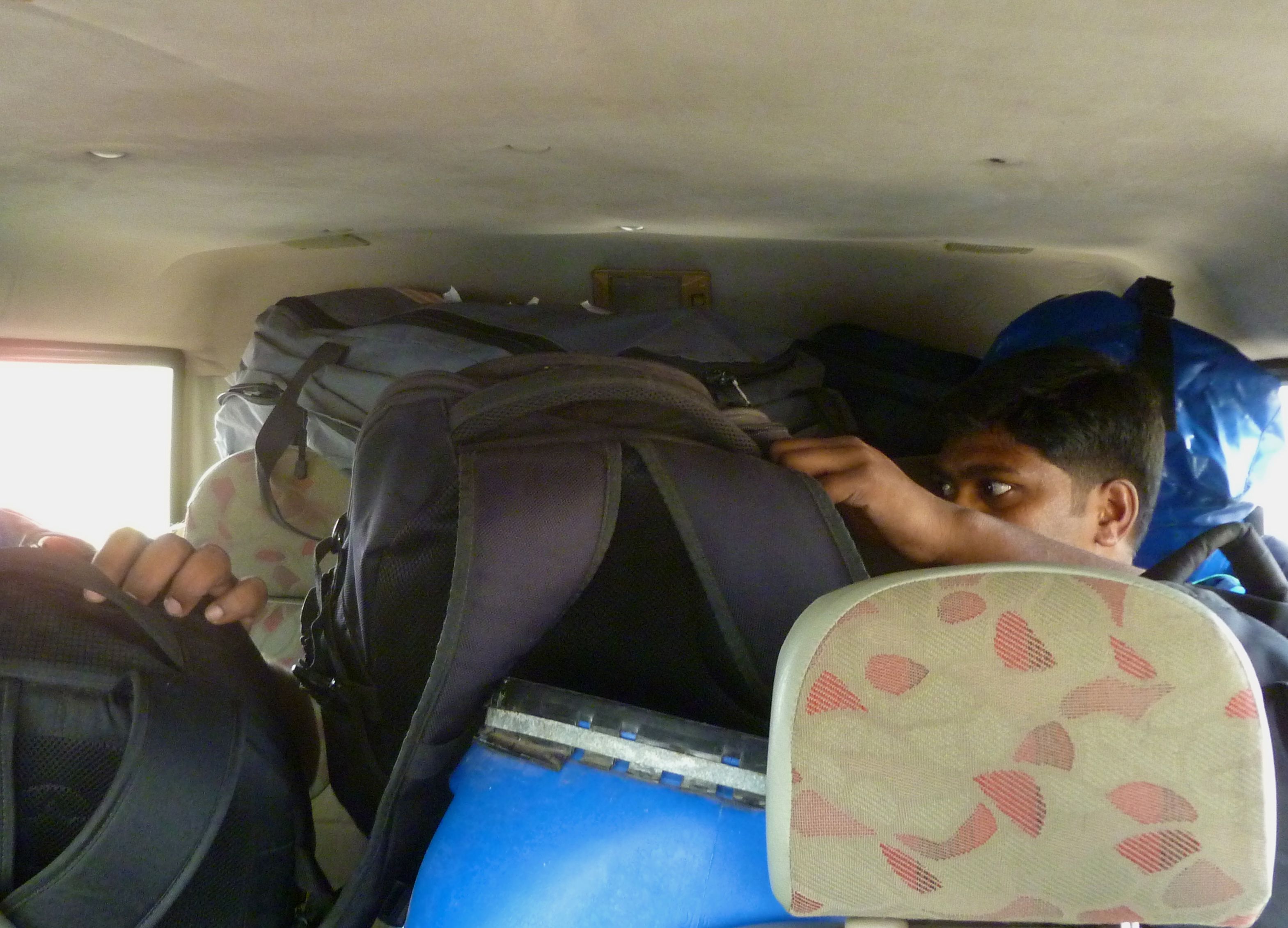
The back of the Jeep (actually a Mahindra 4X4) was totally packed, so we piled more stuff on top of the seated grad students, while the driver and his international guest rode comfortably in front.
We got a late start out of Bharathiar to head to our first real field collection/sampling site, the reserve surrounding the Siruvani reservoir in Kerala, and in a heavily loaded 4X4 with Dr. Mani driving we navigated our way out of Coimbatore to Palakkad and then north into Siruvani. The total distance was not that great, but traffic in inhabited areas is very heavy, and in the spaces in between inhabited areas, the two-lane road is shared by passenger cars, trucks (some are jumbo-sized), farm vehicles, and oxen-pulled haywagons. It seemed almost merciful that those distances between towns were so short, though one realizes how mercilessly dense the population is here that so little space between dense population centers. The relatively short distance traveled just getting to the boundary of the buffer zone—I’d say around 70 km (check later)—took all of three hours. Poor Arun and Magesh were crammed in the back seat with a water barrel between them and luggage on their laps. I carried Dr. Mani’s camera bag on my lap in the passenger seat.
There were four checkpoints to cross between the buffer zone boundary and the Siruvani guest house. The first required some sweet-talking and rank-pulling negotiation on Dr. Mani’s part to be allowed across. Technically no entry is allowed past five o’clock, but there’s a reason he’s called “Sir.” At the second checkpoint there was a sign saying something like “Absolutely no entry,” and starting with the third checkpoint the guard hardly even bothered to check who we were. From checkpoint #4 onward, there was wildlife to be spotted: an Indian Gaur (a very large bovid), two mouse deer, a barking deer, a mongoose, a leopard (yes. A fucking leopard!), a leopard cat. (No, you can’t be jealous yet)
Patiyar is the name of the Siruvani Guest House. It is owned by the Kerala Department of Irrigation and is situated on the end of a headlands jutting into the lake. It was dark when we got in, and when the next morning I woke up to the trumpeting of tusker elephants fighting in the distance, and this view. Yes, now be very jealous. A stay at Patiyar is very difficult to arrange, even for Dr. Mani. It is typically used to host high-level officials who are on holiday.

The view of Siruvani Reservoir from the terrace at Patiyar in the Siruvani Forest, Kerala.

Doing my best to document the events of my trip, which are shaping up as a continual procession of extraordinary experiences.
Arrival in India
29/12/2013
21 December. Summary. Arrived in Bangalore at 1:55 am and had to wait in the transit area for several hours before flying onwards to Coimbatore at 9:30. Met at airport by Dr. Mani and Mr. Arunkumar and taken via taxi to the ARS hotel. Took a brief walk in the neighborhood of the hotel, then fell asleep in the early afternoon. Woken by Arun at 6:00 pm and met Mr. Magesh. Arun called at ~8:00 to inform me that Dr. Mani would not be able to make our dinner engagement, so I took dinner at Sri Arivee hotel next door. There’s nothing terribly interesting to report today, so I’ll talk about air quality.
It used to be that the Los Angeles basin was persistently nestled under a blanket of yuck. I know smog. I grew up in it. Flying in or driving down from the mountains meant penetrating the soft, purple dome.

This was the view from my window seat for the entire flight from Bangalore to Coimbatore. Looking straight down you could barely see through to the fields and towns.
Flying out of Bangalore at 9:30 am I saw something that I haven’t seen since the 1980s. We emerged from a layer of haze into clear blue skies, and the stratification—that inversion layer—was both remarkable because of its sharpness and the extreme contrast between the air below and above and nostalgic, though not in an especially good way.
As I expected, the air quality in Coimbatore is very poor. I suspect that it’s a combination of cooking and waste-burning fires, vehicular exhaust, and coal combustion for energy, but a mixture of gases and aerosols is definitely being trapped within the lowest layer of the atmosphere by thermal/density stratification. There was very little wind in the city and at first I had some discomfort in my eyes and lungs. But we would be leaving the city the next day, I was very, very tired after the long flight (leaving Thursday morning and arriving Saturday).
At street level in Coimbatore air is clear enough, though there is a much “richer chemistry” than what I have become accustomed to since my days in LA in the 70s and 80s.
I suspect that the smog-producing practices here are the same as elsewhere in the tropics—the Amazon, for instance. The difference is that the population of Karnataka and Tamil Nadu (the two states that I flew over) is a thousand times more dense than the state of Loreto in Perú. Even so, there were bad air days in Iquitos as well, but here I suspect that it is the norm, with reprieves occurring only from rain.
My plan—the implementation of which is already underway—is to meet the wild lands of southern India. There’s a lot that’s paradoxical of a country with a population of over a billion people and yet home to one of the named “hottest hot spots” for conservation priorities. Myers et al. (2000) identified sites based on such things as richness and density of endemic plant species and vertebrate species and percent of extent of primary vegetation. In the Western Ghats region (including Sri Lanka) there are 12,450 km2 of primary vegetation remaining out of an original extent of 182,500 km2. That’s 6.8 percent. All of that 12,450 km2 is within the boundaries of protected reserves or national parks, which means that there are no wild lands in southern India except in the reserves.
The way things look on the map is that most of these protected areas are rather small and overall the reserve system is highly fragmented, except in the Nilgiri Hills area where a bunch of reserves and parks are strung together to form the Nilgiri Biosphere Reserve. That’s where I’m going.
My contact in India will be Dr. Mani of Bharathiar University in Coimbatore. He is a prominent fish biologist, whose name I got off the “Fishes of the Western Ghats” posters that I googled up as I was starting to plan this trip. The idea was simple: if you want to see really nice stuff, follow the guy who knows the freshwater fishes. I emailed him to ask if he had a grad student I could pay to take me to some of the collection sites for his research, and the response was basically “Heck, I’ll take you around myself!” Bonus.
So for the next couple of weeks there will be a couple of older dudes (and maybe a grad student or two in tow—you know, to carry the luggage) tooling around in some remote-looking stretches of the last remaining wild lands in southern India. We’ll be collecting fish, identifying plants and insects, pulling leeches out of our socks, and maybe swimming under waterfalls along the way.
But right now I’m in the Lufthansa lounge in Frankfurt washing down unlimited free pretzels with unlimited but rather warm beer. I plan to sleep the whole flight to Bangalore.
Retracing Darwin’s trip to Santa Fé
23/07/2011

“…we stopped at a pulperia, or drinking-shop. During the evening a great number of Gauchos came in to drink spirits and smoke cigars.” p.44
After a little more than a week in the lowland tropics of Perú I was completely thrown by the change of scenery upon my arrival in wintry, über-urban Buenos Aires. Mike had invited me to crash for the next week at the San Telmo apartment he shares with Guille, Clyde, and Puti, and although I was determined to be a good guest it was hard–insurmountably hard–for me to pretend to enjoy being in the middle of a city.
Things started looking up when Mike and I put together plans to re-trace a little road trip from Buenos Aires to Santa Fe taken by Charles Darwin and documented in his book The Voyage of the Beagle. In his journal entry for 27 September 1830 he writes, “In the evening I set out on an excursion to St. Fé, which is situated nearly three hundred English miles from Buenos Ayres, on the banks of the Parana.” His return to the capital in late October was impeded by a violent revolution for which rebels had blockaded the city–this was a problem for Darwin, because he needed to rendezvous with Fitzroy and the Beagle or else be left behind.

“I had now been several days without tasting anything besides meat: I did not at all dislike this new regimen; but I felt as if it would only have agreed with me with hard exercise. I have heard that patients in England, when desired to confine themselves exclusively to an animal diet, even with the hope of life before their eyes, have hardly been able to endure it. Yet the Gaucho in the Pampas, for months together, touches nothing but beef. But they eat, I observe, a very large proportion of fat, which is of a less animalised nature; and they particularly dislike dry meat, such as that of the Agouti.” p.123
Darwin made his trip on horseback and had to keep a wary eye out for hostile natives–his visit coincided with the height of a war between European settlers and several hostile factions of native Argentines. In contrast, Mike, Clyde, and I had the advantages of nice roads and a rented Peugot SUV, and we figured we could hit more than a few of the highlights from Darwin’s month-long trip in the span of a day and a half. 🙂
Lunch stop was at a parrilla/pulperia outside of Rosario. An assortment of meats are brought to the table on a mini-parrilla. Meaty. Argentina as I understand it has the highest per capita consumption of beef at 64.6 kg per person in 2009 (wikipedia). This is something that is not dramatically different from Darwin’s time, at least based on the account of his diet while in Argentina.

“Before arriving at Rozario, we crossed the Saladillo, a stream of fine clear running water, but too saline to drink.” p.132
Darwin noted that many of the rivers throughout this area (and even south of Buenos Aires) are salty. Later in our trip we would make a stop at a thermal/mineral springs spa in Victoria, Entre Rios, and the water there was intensely saline. Problematic for agriculture as well as for livestock, Darwin noted: “All the small rivers became highly saline, and this caused the death of vast numbers in particular spots; for when an animal drinks of such water it does not recover.” (p.142)

“The cliffs are the most picturesque part; sometimes they are absolutely perpendicular, and of a red colour.” p.132

“I reached the place of our bivouac by sunset, and drinking much maté, and smoking several cigaritos, soon made up my bed for the night. The wind was very strong and cold, but I never slept more comfortably.” p.115
Darwin spent most of 1 October 1830 hunting for fossils in the exposed sedimentary rock near the Arroyo Saladillo. Among his findings on that one day were two large skeletons, one of which was a mastodon, and the tooth of Toxodon, an extinct rhino-like mammal. The eroded sandstone cliffs that Darwin describes in The Voyage of the Beagle are still around, if substantially less inviting for fossil-hunters. People living at the tops of the cliffs use the precipices as their personal garbage dumps. It’s pretty gross.

“In the morning we arrived at St. Fé. … I was confined for these two days to my bed by a headache. A good-natured old woman, who attended me, wished me to try many odd remedies. A common practice is, to bind an orange-leaf or a bit of black plaster to each temple: and a still more general plan is, to split a bean into halves, moisten them, and place one on each temple, where they will easily adhere.” p.134
Having read The Voyage a while ago, I recalled a few things that I could no longer find as I re-read the book in preparation for this trip. For example, I was sure that there was a passage in which Darwin assocates some positive attributes of Pampas-dwelling native Argentines (compared with the lackluster Fuegians, who didn’t impress Darwin at all) with their heavy consumption of yerba mate, a tea whose caffeine content could certainly account for the “strong work ethic”–or whatever positive character trait that Darwin was (in my memory) describing in his praise of the Pampas natives. Today mate is drunk by almost all Argentines–and you see people everywhere carrying their mates, bombillas, and thermoses of hot water in specialized totes. When we got to the city of Paraná (corresponding to the town known as Santa Fé Bajada in Darwin’s time?) we found a cool little shop with a gigantic mate over its storefront. We bought some stuff, the owner engaged us in conversation for hours, and ultimately pointed us in the direction of a residencial where the three of us could hole up for the night.

“This river is also called the Saladillo, and it deserves the name, for the water is brackish. I stayed here the greater part of the day, searching for fossil bones. Besides a perfect tooth of the Toxodon, and many scattered bones, I found two immense skeletons near each other, projecting in bold relief from the perpendicular cliff of the Parana. They were, however, so completely decayed, that I could only bring away small fragments of one of the great molar teeth; but these are sufficient to show that the remains belonged to a Mastodon, probably to the same species with that which formerly must have inhabited the Cordillera in Upper Peru in such great numbers.” p.134
In the city of Santa Fé proper, there would be little that we could count on to connect with Darwin’s text. When it comes to human settlements things will have changed beyond recognition–several times–over the course of 180 years. As sort of a joke I asked Mike to stop at a pharmacy, where I walked in and complained of a headache. The treatment I was recommended and sold was a bit more familiar than what Darwin received when he was here.

“We continued to ride over plains of the same character. At San Nicolas I first saw the noble river of the Parana.” p.133
I found it deeply disturbing that throughout this entire trip we found almost no form of commemoration of Darwin’s presence. We stopped at several points to ask locals if there was any kind of monument or statue of Darwin. In most cases we got directions to the only monuments of which they were aware–I think one was a memorial to the unknown meat-industry-worker in Rosario (but that might be a flaw in my interpretation of Spanish). I got the feeling that few here are even aware of who Darwin was, and those who recognize the name are surprised to find that this corner of Argentina figures significantly in one of his most well-received works.
So we were thrilled to find “Darwin” on a wall (it looked like a street name, though on a map the same street had a different name), near the Arroyo Saladillo. This was the only vague glimmer of commemoration that we encountered in our trip. There are actually two Saladillos mentioned in The Voyage, and it’s likely the second one (which Darwin notes is also known as the Tercero) that was the site of his fossil findings. We crossed over an Arroyo Tercero as well, but this was well after dark and not a good time for us to pull off to look for Darwin souvenirs.

“At some future day this must be one of the richest countries of La Plata. The soil is varied and productive; and its almost insular form gives it two grand lines of communication by the rivers Parana and Uruguay.” p.135

“The wooded banks of the great rivers appear to be the favourite haunts of the jaguar; but south of the Plata, I was told that they frequented the reeds bordering lakes: wherever they are, they seem to require water.” p. 142
The Paraná is an immense river of almost the same scale as the Amazon. Its watershed includes most if not all of the nation of Paraguay as well as sizable portions of Brazil, Bolivia, and Argentina. When Sharkey and I went to Mato Grosso do Sul a few years ago, we swam in this same watershed, two countries away.
Darwin’s marvel at the economic potential of the Entre Rios–this area between the Paraná and the Río Uruguay (which is also the border with the nation of Uruguay) is clear from his words of praise in The Voyage. Even today the area’s economy focuses on productivity of the land–however, things are changing dramatically. The tradition of strictly free-range Argentine beef has been violated, and the use of US-style feedlots is growing rapidly. The vast acreage of what used to be pasture is being converted for the cultivation of soya. And in case you’re wondering, all of this soya is exported to Asia and not being made into high-quality Argentine tofu.

“Owing to bad weather we remained two days at our moorings. Our only amusement was catching fish for our dinner: there were several kinds, and all good eating. A fish called the “armado” (a Silurus) is remarkable from a harsh grating noise which it makes when caught by hook and line, and which can be distinctly heard when the fish is beneath the water. This same fish has the power of firmly catching hold of any object, such as the blade of an oar or the fishing-line, with the strong spine both of its pectoral and dorsal fin.” p.143-144
With the hopes of seeing some relatively undisturbed Paraná habitat, we targeted the Pre-Delta National Park, just outside of the town of Diamante. At the time of our visit, the availability of activities here was truly bare-bones: two very short trails that would offer visitors a very short nature hike/bird watch opportunity. The majority of the park’s acreage (which is really not large at all) was inaccessible. Still Mike was able to exercise Clyde and we got to see some wildlife, including the small parrot that Darwin mentions in The Voyage.
Having explored this part of the Paraná, Darwin was supposed to sail/float back down to Río de la Plata and ultimately to Buenos Aires on a balandra, a single-masted vessel that was also carrying one hundred tons of unspecified cargo. But a spell of lousy weather combined with a wimpy captain–and Darwin suggested as much (“In the evening, the wind being not quite fair, as usual we immediately moored, and the next day, as it blew rather freshly, though with a favouring current, the master was much too indolent to think of starting.” p.148)–kept them from making a lot of progress back towards the capital and Darwin’s arranged meeting with Fitzroy. On the plus side, it gave Darwin a chance to do some fishing.

“A small green parrot (Conurus murinus), with a grey breast, appears to prefer the tall trees on the islands to any other situation for its building-place. A number of nests are placed so close together as to form one great mass of sticks.” p.146
It is truly unfair to my hosts that I have only this one blog entry for my enitre week in Argentina, compared with several posts for an approximately equal time spent in Perú. I greatly enjoyed the time spent with Mike and Guille. Their lives near the heart of a large capital city–we walked from the apartment to the Casa Rosada on my first afternoon there–is at once familiar (I grew up in one big city and endured another for grad school) and foreign. I suppose I could have made more of an effort to see the city through the eyes of someone who cares about the Museum of Whatever or the Cathedral of St. Yadda, or tangoing in the Plaza de Qualquier Cosa or strolling down the Avenida Muymuy Ancha (this stroll is, btw, something I actually did!). Yes, I really should have made this effort.

“How different would have been the aspect of this river if English colonists had by good fortune first sailed up the Plata! What noble towns would now have occupied its shores!” p.147
But I came to Argentina to visit Mike, not Buenos Aires. We ate some beef and sipped some mate, which is exactly what I expected to happen. We’ve known each other since seventh grade, and our exchanges today are not appreciably different from the way we got along thirtysomething years ago. Making the acquaintances of Clyde, Guille, and Puti was also part of the plan, and that went well also.

“We then rode on to our sleeping-place, and had for supper ‘carne con cuero,’ or meat roasted with the skin on it. This is as superior to common beef as venison is to mutton.” p.199
The Darwin-themed trip was also sort of planned–it’s what I suggested to Mike as a possible “fun outing” in our email exchanges before I came. Mostly, however, it was done in the same spur-of-the-moment, impulsive, hair-up-your-ass kind of mindset that I think Darwin had when he was here. Keep in mind that it was a strapping young Charles who took the journey in 1830–not the ancient-looking bearded gentleman that comes up if you google “Darwin.” The man was truly an epic badass. If you haven’t read The Voyage, I highly recommend it–even moreso than Origin.
Parade of fruit
11/07/2011

clockwise from left: dale-dale, pan de árbol (in bag), granadilla, cacao, macambo seed, pan de árbol
[This is really a post-script to what is otherwise a completed blog series. Karen was our designated documenter-of-fruits, and I couldn’t post this without consulting with her–a bit difficult as she is presently in Massachusetts. After a couple of email exchanges, we’ve put this together as what will be the final post for my blog of South America 2011.]
As I saw it, nearly all vegetable matter we sampled (with the exception of citrus, banana, guava, and pineapple) would be unfamiliar to a typical norteamericano. Even some of the familiar items would turn out to offer surprises–I (embarrassingly) never actually ate a straight-up regular banana while I was there, figuring that it wouldn’t be appreciably different from the ones we buy in the states. Karen now tells me that they were way better and that she downed twelve of them just in the couple of days after I left. Sheesh.
The parade of exotic fruit started from shortly after my arrival. Seth, having lived in Iquitos since October of 2010, knew what most things were, but we bought interesting produce all the time–usually something Karen or I couldn’t recognize at a market or on the stand of a street vendor. Other times–such as during one of the botanical tours–we would be shown a tree in someone’s huerta and if there was a ripe fruit available we could for a sol or two get one opened on the spot for an immediate sample. Here’s a running list of the fruit, compiled from my notes and Karen’s.

camu camu on the property of the gentleman who sold us leva nearby to the River Itaya
Camu-camu. Myrciaria dubia in the Myrtaceae –we bought some from a street vendor and prepared and agua fresca back a the hostel. a very tart, small dark red fruit with a rather large seed. washed, then placed in a bowl submerged with water and crushed by hand, forming a chunky juice which was then strained; added sugar to taste…very refreshing. Making an agua fresca seems to be the principal way in which this fruit is consumed–I didn’t see any other preparations. The plants are tall bushes that grow on the riverbanks in the flooded zone, i.e., dry during the low-water period but under water when the river is high. It turns out that I have a congener of this plant (Myrciaria cauliflora, the Jaboticaba) growing in my back yard–it’s a very slow-growing plant.
Mocambo. Theobroma bicolorin the Malvaceae–formerly classified within the Sterculiaceae (for the benefit of the geezers ;-)) – first, we enjoyed the creamy, flesh inside this large pod, then you remove the seeds and roast–slightly salted, they make a great snack! This was definitely a favorite. We first encountered just the roasted seeds at a fruit stand, and they were so good that from then on they sort of became an obsession.

seed, right out of the fruit and covered by creamy, fragrant, sweet pulp
Compared with other items toasted mocambo seeds were a bit pricey, and when Karen found them in a supermarket in a packaged-food form, they were singly wrapped–little did we know at the time how labor-intensive their preparation was. We also found them being roasted on skewers at the market in Bellavista Nanay.

endosperm after peeling away the seed coat. it looks like the germ got bitten off of this one
It wasn’t until Wilder opened up a whole fruit for us at Yanayacu (see video) that we got a full appreciation for the whole fruit. The outer shell is very tough and can be dried hard for use in handicrafts (there was a goblet made from a mocambo shell at our hostel). The creamy pulp surrounding the seeds is fragrant–reminiscent of durian, though much less strong–and sweet. And after eating off the fleshy part, the slimy remains are slippery and hard to hold as you’re trying to peel off the leathery seed coat to expose the edible endosperm and germ. It’s a lot of work–pleasant work, though–to get just one of the seeds to fry or roast for a snack. Between Wilder, Seth, Karen, and me, we peeled all twenty or so of the seeds that was in the fruit that Wilder opened.

the inflorescence of Artocarpus gives rise to a multifaceted globular compound fruit
Pan de árbol. Artocarpus camansi in the Moraceae. This was identified for us as “breadfruit,” but on further investigation (at home), the true breadfruit is not seeded and is a different species, A. altilis. This plant we saw and tasted was really the breadnut, which is closely related to breadfruit. Both breadnut and breadfruit are not native to Peru, originating in southeast Asia. We purchased the cooked seeds (which look like a small chestnut) from a roadside stand. starchy texture. I can sort of understand this as adding body and calories to a larger, more complex dish, but peeling these pistachio-sized chestnuts for a lump of bland foodstuff was not particularly inspiring.

some good stuff to take back to the hostel for later: that's a pineapple on the left (Karen's right) and a copazú, which Seth later turned into a lovely frullato
Copazú. Theobroma grandiflorum in the Malvaceae. Karen’s notes has this as having a very pungent aroma, though I remembering that it smelled kinda nice. (Then again, I love the smell of skunks.) Although we bought a nice copoasú, neither Karen nor I were unable to document its opening and preparation, all because of Seth. 😀 This sneaky kid goes and opens the thing and makes an agua fresca when we weren’t looking. The drink was white-ish with a pale green tinge, kind of like what you might expect for a honeydew licuado. The fragrance was not strong at all, and I remember thinking that it was good, though I can’t recall the flavor well enough to describe it.
Since the pic with Karen also shows a pineapple (Ananas comosus of the Bromeliaceae), I ought to mention that while this is grown as a cash crop in this area, it is not native to the Amazon basin (though it is native to South America).

dale-dale look and taste incredibly like potatoes, but peeled and eaten raw they have a crisper texture.
Dale-dale. Calathea allouia in the Marantaceae, which is the arrow-root family. The tubers look and taste remarkably like small potatoes (in the literal sense and not the metaphorical “small potatoes”). The texture of the dale-dale, which are peeled and eaten raw, is crisp and watery–more water-chestnut-like than potato-like. This is another crop native to this part of the world.
It appears there dozens of species of Calathea (and perhaps other genera of Marantaceae) that grow around here, and I should mention that the larger-leaved varieties are harvested for use in the preparation of juanes–the tamales made with rice instead of masa.

aguaje palm fruit for sale at the market in Bellavista Nanay. the labor-intensive part of peeling off the tough, red shell is done by skilled hands.
Aguaje. Mauritia flexuosa in the Arecaceae. The oval-shaped fruit of this palm–about the size of a large kiwi–are brownish red before peeling. Displays of the peeled fruits add brilliant color to every market we saw in Iquitos. The edible part is really just the thin layer of richly flavored (not sweet) orange pulp between the hard shell and a leathery seed coat, and a large, inedible seed makes up the bulk of what you buy. Two approaches to eating the thing are A) just scrape the orange stuff off with one’s incisors, and B) peel the seed coat off with the pulp and scrape the good stuff off like one does with artichoke leaves. I liked the second approach much better. The orange pulp is also mixed with sugar and water to make a very nice beverage and also to make some yummy popsicles–which Seth loves–and are sold by street vendors.

yummy suri grubs--larvae of the giant palm weevil Rhynchophorus palmarum--are harvested from rotten aguaje palm trunks and stewed or roasted for a fine (if greasy) snack food
The aguaje fruits may be harvested by climbing mature trees and cutting off the infructescenses, but sometimes the trees are just cut. The advantage to killing the tree is that it makes habitat for the suri grubs–large, edible larvae of what must be one big beetle. The suri are therefore also kind of a “food product” from the aguaje palm, and they are truly delicious, either stewed or roasted.

the cashew nut is inside the little thingie on the left. the rest of the fruit is a seed-free mass of mildly sweet pulp (when ripe)
Cashú. Anacardium occidentale in the Anacardiaceae. What we all know as cashew nuts are just a part of the much larger fruit that we never see in our markets. The large, seedless fruit to which the nut-sack attaches (sorry, that’s just what it is), is a mild-flavored pulpy fruit widely used throughout the tropics as the base of a fruit drink. We picked fresh from the tree, the one we sampled wasn’t quite ripe.
Another Spanish name for the cashew is marañón, which is also the name of the river we set sail from in Nauta–one of two rivers (the other being the Ucayali) that become the Amazon River in Perú.
Granadilla. Passiflora ligularis (I think) in the Passifloraceae. Compared with the P. edulis that I grow at home in California, this fruit has a softer, pulpier skin and sweeter (or at least less acid) juice. I have had other varieties of maracujá elsewhere, and to me this was pleasant though not as good as the large, orange variety found in Brazil.

cacao pod, opened and showing the pulp-covered seeds. The pulp is the part you eat fresh
Cacao. Theobroma cacao in the Malvaceae. This was kind of an old friend for me–I’d had it a few times before (not counting in the form of chocolate). You open the shell to expose rows of seeds covered by a slimy, fragrant and very sweet pulp. Toss a couple in your mouth, suck the pulp off, and then spit out the seeds. Yum.
Sapote. Hmmm. another embarrassing gap in my records–no notes and no pics. I do recall a pleasant, sweet flavor and a very sticky sap–particularly in the skin. Fruits known as “sapote” may come from either the Sapotaceae or the Rutaceae, and based on the stickiness I’m inclined to think that the green fruit we ate (on a couple of occasions) were in the former group. But I’m not sure.
